Balad Geotechniks
we strive for accuracy and quality in our surveys…
we strive for accuracy and quality in our surveys…
The world is going smart; there are smart phones, smart cards, smart sensors, smart satellites and now smart cities. A smart city would be one that manages itself intelligently and appears neat and well groomed. Smart cities will cleverly adopt an open and shared data approach, under which combined data can be used for multidimensional analysis. Effective geospatial policies for development will enhance effective city planning and management, this will in turn leads to smart governance. In Balad Geotechniks Global Impacts Limited we see surveying beyond art of measuring distances and directional angles to produce a chart, but rather we see our end products as adequate tools for decision-making and effective governance.

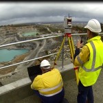
 What can our monitoring services deliver? Precise measurement of lateral and vertical movement, settlement and shortening of structures On-site installation of sensors (connected online) gives you real-time access […]
Read more
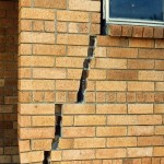
Why do you need a Dilapidation Survey? Saves you peace of mind and money on litigation and the costs of remedial repair works for damage caused by someone […]
Read more